 efore we stopped for lunch. We thought it was going to be a quick stop but the dads needed some things. Andrew’s dad got some last minute food items and my dad bought some warmer socks (they were 40$....what!?). We were finally in the Williamsport area by around 3:30pm. The first order of business was parking my old cavalier at the southern terminus to await our return and provide a shuttle to the other vehicle. We switched all of our packs into the Rav 4 and continued on to the trail head where we arrived closer to 5. We were finally standing on the trail and the sun was almost setting on our first day.
The initial miles of the trail took us up a steep ascent of the rim overlooking the beautiful PA Grand Canyon (Pine Creek Gorge). Before we came to the top of the first elevation our hiking boots sloshed into snow instead of the expected dirt and stones. Hiking in snow was a lot more intense and exhausting then on dirt paths. Our steps became shorter because it was easier to los
 e our footing. By sundown we had only gone 3 miles…much to our surprise. We took in the first breathtaking view of the canyon just as the sun fell past the trees. Tired and hungry we decided to make camp earlier than planned. We got set up and Andrew and I set out to build a campfire to warm up. My dad took his time setting up his Hennessey hammock (google search…very sweet design) right on the ridge with a cliff right beneath. The cold was seeping through the layers and only hot coffee with Pastor Andy’s tortellini recipe could warm us up. We turned in for the night expecting a big 10-15 mile day with the sunrise.
After a cold night we woke up to the amazing view of the canyon lit by the early sun and we made breakfast while preparing for our big day. We kept our fleeces on through the morning hours of the hike to beat the chill. We soon realized we were not only up against the 3-6 inches of snow, but even worse, frozen mud. Our trekking poles saved us from many falls.
 We made our way up and down the rolling mountains in and out of snow covered trails and eventually found a good spot for lunch about 8 miles later. Hot tea, soup, and ravioli never tasted better. Filtering water proved to be more of a chore than normal because the cold air around the water made the temperature feel even lower. We continued on, trudging and sometimes falling through the slick conditions and decided to make camp for the night at vista just past the 19 mile mark. It had been a long day. Our muscles stiffened as we set up the tent, worked up a fire and enjoyed some hot dinner around the flames. Just getting up from our seats and into the sleeping bag showed the toll the trail was taking on our bodies. We decided that the exhilarating views and scenery were well worth the workout.
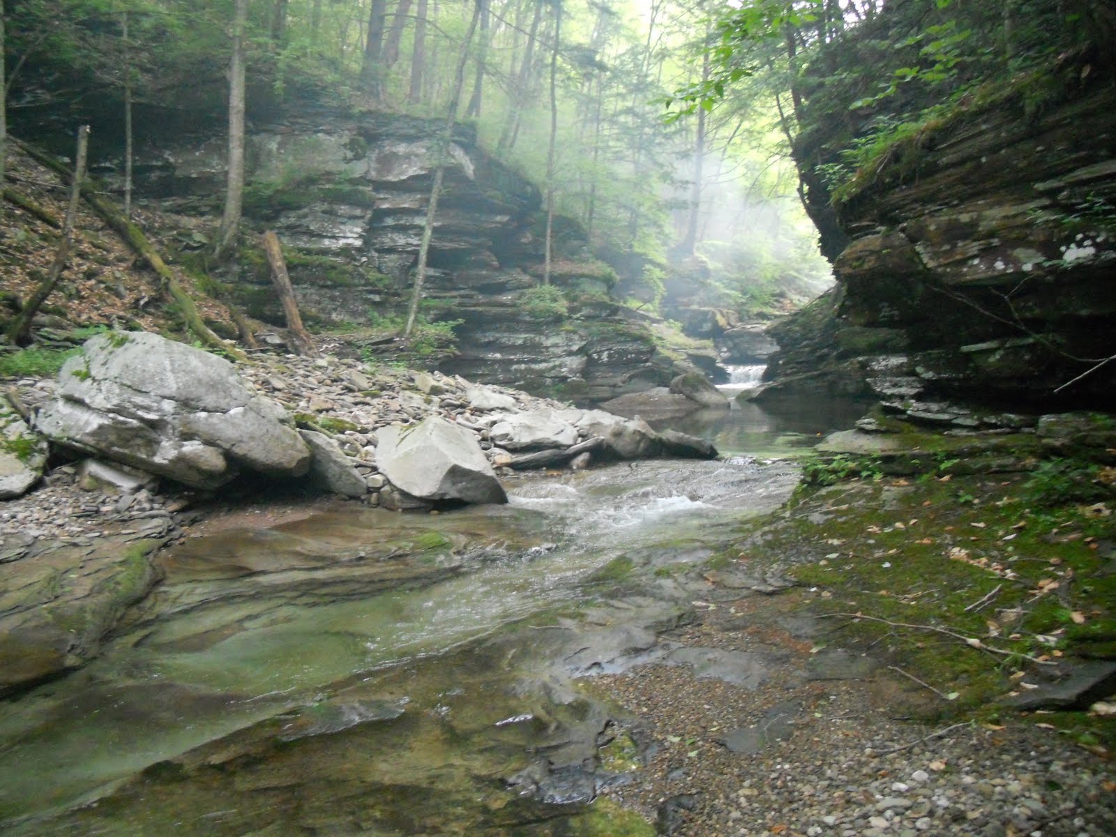
This morning we woke to a colorful sun rise over the rapids far below. A mist rose from the water creating a photogenic sight. Packing up our gear for the last time… we made the decision to eat breakfast on the go as we filtered some water about 2 miles up from where we made camp. This day became warmer than the first and our fleeces we stuffed into the pack. After raging war with the snow and invisible frozen mud for another 3 miles, we had a choice to make. Do we continue the trail or take the downhill smooth road way out? They left the decision up to me and after reading the guys and taking into account the danger of injury due to the slippery rocks
 and trail if we would continue, now somewhat worn by the trail… I opted with the road. They readily agreed and we began blazing the trail down the road. We soon realized that snow on the road was a lot more slippery than on dirt. You could almost skate down the slopes and had to dig your poles into the ice as we made our way up and over and down and around the twisting and turning road. We thought we were close but still had more than 5 miles to go on that road, followed by an unknown distance on a connecting road to the parking area. When we needed a boost the hot pasta sides and coffee once again refueled us. We came to resent the work it was taking just to connect our waypoints. The mile countdown continued on and the road became a steady descent. Knees wobbling under the pressure and poles digging in to prevent falling, we were able to zig- zag our way slowly down the mountain side. The descent lessened and we came to the end of the road and turned right to make our way to the car. I think we cele
 brated a little too early because it wasn’t “just around the next corner” like we thought. A passing pickup truck and Pastor Andy jokingly sticking out his hitch hiker thumb proved to be our saving. She pulled over and offered her truck bed to us. We were even more thankful after realizing the lot was a good 10 minute drive from where she had picked us up. We made quick business of getting out of our boots and the 4 of us packing into my little blue car.
One thing we hadn’t thought of was the fact the GPS we were relying on for shuttling us to the other terminus was still in the Rav 4. Not good. We all strained our memories to recall the way we originally took as the sun was setting and making it that much harder. My dad’s iphone came through for us and we reached the car by 7. We found the closest restaurant and filled ourselves up with some good post hiking food. So good. Pastor Andy made his way home and my dad jumped into the car with us. We were in our own bed by 1 am. Good memory but wouldn’t wanna hike in snow without snow shoes again!


 The clouds were coming in, and thunderstorms were forecasted, so we set up fast. Right when we were set up, we ate another delicious dinner provided by Britt. I decided to eat right on the outcrop. When I began to get comfortable I moved a bit and sat my hand down. Much to my surprise, my hand was on the back of a large rattlesnake. I’m assuming it’s the same one as before. It had been lying right under the surface of the rock on a small ledge below. My fingers wrapped over just enough to startle it (and me). After that I figured I had pushed my luck enough for the day and we ate around a campfire. We made sure the tents were zipped up tight that night. We all slept well enough, and woke up screaming only once…a false alarm…ha. It never did rain…